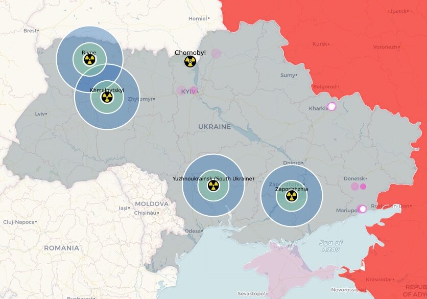
Interactive map shows threat to Ukraine’s reactors

Greenpeace International has created an interactive map displaying the locations of Ukraine’s nuclear power sites and their proximity to Russian military forces since the invasion on February 24, 2022. Using publicly-sourced information, it tracks, at fixed time intervals, the movement of the Russian military and makes clear how vulnerable Ukraine’s civilian power reactors are as a result of the illegal invasion. Ukraine has 15 commercial reactors at risk, at four sites, plus the defunct and highly contaminated site at Chornobyl.
Greenpeace International reports on the specific risks to two nuclear power sites in the south of Ukraine (Zaporizhzia and Yuzhnoukrainsk/South Ukraine), where Russian forces seem to be refocusing. These reports can be accessed by clicking each site on the map. Details on data sources and instructions for using the map are at the site as well.
Support Beyond Nuclear
Help to ensure a safer, greener and more just world for all

